![]()
![]()
![]()
![]()
|
|
|
|
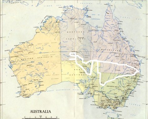
Central Australia Trip - The BIG Picture9000 kms
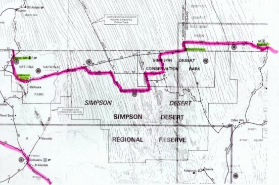
Map of Simpson DesertCrossing from Birdsville to Mt Dare
Birdsville to Mt Dare was 614 kms between fuel stops - no trouble, with the big extra tank on the Landcruiser! |
|
Send mail to judy@jwsmith.com.au with
questions or comments about this web site.
|